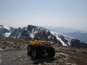
ATV on Canoe Mountain
With a peak elevation of 2621 m, “Sea to sky” trail a must do trip while recreating around Valemount. An old road system will take you from the valley bottom to 360 degree views of the entire area including famous Mt. Robson. Once at the end of the road system, short hikes can be done to see emerald green alpine lakes, flowers, wildlife and amazing opportunities for the nature photographer. This trail is best accessed from the Kinbasket Lake area and takes riders to elevations of 8,000′ + showcasing breathtaking views of the Valley.
To access the staging area for the complete Sea to sky trail, travel 1km south of Valemount on Hwy 5 and turn left at the first intersection where you will see signage for the Kinbasket lake. Remain on this road for 7.5 km where you will reach the intersection of the East and West side roads. Turn right here and travel another 1km crossing the Canoe River and take your next right where you will find the staging area. This trail is sparsely signed from here you will utilize old road systems and right of ways to get to the top of Canoe mountain.
Should you choose not to access the trail from the Kinbasket lake area there is also simple off highway access although this does shorten the trip substantially. For off-highway access to this area, drive 15 km south of Valemount and look for a small turn off at the base of the mountain. This road is unmarked and comes up fast, so keep your eyes open. There is small area for parking and space to turn around. GPS Coordinates for the Turn Off are 52 41’47.51” N 119 14’57.78” W
Enjoy the ride, although please remember to REMAIN ON THE TRAIL AT ALL TIMES !


